+2.4 °C
Temperature
20502080
- Higher emissions SSP5-8.5
- +1.6 °C → +2.4 °C
- Lower emissions SSP2-4.5
- +1.4 °C → +1.9 °C
Hottest month +2.3 °C by 2080 (SSP5-8.5).


Dem. Rep. Congo: high governance pressure, led by flood exposure.
The composite and its five dimensions. Higher means more risk.
High 62 / 100
Physical hazard intensity. INFORM Risk Index, 0 to 10.
Risk-ranked against its cohorts. Click any country to open its page.
Compare with any neighbour on all risks and their 5-year trajectory.
Projected physical change under a moderate (SSP2-4.5) and a high (SSP5-8.5) emissions pathway.
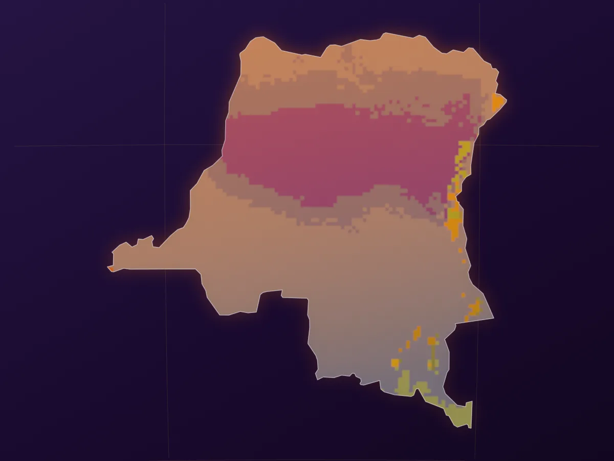
By 2080 under a high-emissions pathway, Dem. Rep. Congo is projected to warm +2.4 °C, with annual rainfall changing +180 mm.
+2.4 °C
Hottest month +2.3 °C by 2080 (SSP5-8.5).
+180 mm
Driest month -1 mm by 2080 (SSP5-8.5).
3.7%
Share of land under high or extreme water stress; 0% today.
5.2%
Land exposed to a 100-year river flood; 4.3% today.
Dem. Rep. Congo: under high emissions, a 100-year coastal flood in 2080 could reach 1 of its largest cities.
Max depth: the deepest water within 12 km of the city center in a 100-year coastal flood in 2080, under RCP8.5 with high-end sea-level rise (95th percentile), ignoring flood defenses and land subsidence. Source: WRI Aqueduct Floods.
Regional estimate for the country's coast (IPCC AR6 median), not the global average.
Projections from public CMIP6 (WorldClim 2.1, 5-model median, against a 1970-2000 baseline), WRI Aqueduct 4.0 and IPCC AR6 data. Monthly and bioclimatic aggregates, not daily-threshold indices. Forward-looking estimates, not a re-scored site risk.
Every source-level indicator behind the dimensions above. Sort by score, value, or name.
Access to Clean Fuels | 4.30 % population | 95.7 |
Flood Risk | 7.00 0-10 | 70.0 |
Energy Imports | 1.60 % of energy use | 68.9 |
Land Surface Temperature | 27.9 deg C change | 66.3 |
Energy Intensity | 12.5 MJ/$2017 PPP GDP | 64.8 |
Cooling Degree Days | 4277 degree days | 58.5 |
Drought Index (SPEI) | 0.10 index | 57.9 |
PM2.5 Air Pollution | 26.6 ug/m3 | 27.1 |
Renewable Electricity Share | 90.4 % of total | 9.6 |
Coastal Protection Needed | 29.9 % coast | 9.0 |
N2O Emissions Per Capita | 0.16 kt CO2e per capita | 3.6 |
Energy Use Per Capita | 391 kg oil eq per capita | 1.9 |
Heating Degree Days | 9.30 degree days | 0.1 |
Heat Index | 0.05 index | 0.0 |
Renewable Energy Share | 96.3 % of total energy | 0.0 |
Fossil Fuel Consumption | 3.97 % of total | 0.0 |
CO2 Emissions Per Capita | 0.03 metric tons | 0.0 |
Coal Electricity Share | 0.00 % of total | 0.0 |
Dam Capacity | 1.00 0-1 | 100.0 |
Projected Vector Disease Change | 1.00 0-1 | 100.0 |
Dependency Ratio | 1.00 0-1 | 100.0 |
Environmental Treaties Engagement | 1.00 0-1 | 100.0 |
Agricultural Capacity | 1.00 0-1 | 99.7 |
Paved Roads | 0.99 0-1 | 99.0 |
Health Expenditure Per Capita | 0.96 0-1 | 95.8 |
Projected Cereal Yield Change | 0.95 0-1 | 94.7 |
Access to Reliable Drinking Water | 0.90 0-1 | 89.7 |
Access to Improved Sanitation | 0.88 0-1 | 87.9 |
Age Dependency Ratio | 0.87 0-1 | 87.2 |
Protected Areas | 13.8 % of land | 86.1 |
Slum Population | 0.79 0-1 | 79.1 |
Electricity Access | 0.79 0-1 | 78.7 |
Protected Biome Areas | 0.78 0-1 | 77.9 |
Quality of Trade Infrastructure | 0.69 0-1 | 69.2 |
Projected Warm Period Change | 0.66 0-1 | 65.7 |
Projected Annual Runoff Change | 0.59 0-1 | 59.2 |
Projected Flood Hazard Change | 0.59 0-1 | 58.8 |
Natural Resource Depletion | 33.1 % of GNI | 57.8 |
Forest Depletion | 9.97 % of GNI | 56.8 |
Rural Population | 0.57 0-1 | 56.6 |
Food Production Index | 123 index | 51.4 |
Projected Biome Distribution Change | 0.49 0-1 | 49.4 |
Agriculture GDP Share | 17.4 % of GDP | 48.5 |
Urban Concentration | 0.43 0-1 | 43.4 |
Forest Area | 54.7 % of land | 42.2 |
Earthquake Risk | 4.20 0-10 | 42.0 |
Projected Hydropower Change | 0.37 0-1 | 36.9 |
Projected Climate-Related Deaths | 0.36 0-1 | 36.4 |
Water Dependency Ratio | 0.30 0-1 | 29.9 |
Child Malnutrition | 0.30 0-1 | 29.8 |
Projected Groundwater Change | 0.25 0-1 | 25.0 |
Tree Cover Loss | 1247857 hectares | 19.1 |
Agricultural Land | 15.5 % of land | 17.9 |
Projected Marine Biodiversity Loss | 0.18 0-1 | 17.7 |
Threatened Mammal Species | 32.0 count | 16.8 |
Natural Capital Dependency | 0.11 0-1 | 10.6 |
Food Import Dependency | 0.07 0-1 | 6.9 |
Freshwater Withdrawal | 0.08 % of internal resources | 2.9 |
Energy Import Dependency | 0.02 0-1 | 1.6 |
Projected Sea Level Rise Impact | 0.00 0-1 | 0.1 |
Population Below 5m | 0.00 0-1 | 0.1 |
Tsunami Risk | 0.00 0-10 | 0.0 |
Freshwater Withdrawal Rate | 0.00 0-1 | 0.0 |
Water Stress | 0.23 % | 0.0 |
Poverty Rate (National) | 56.2 % population | 100.0 |
Fertility Rate | 6.05 births per woman | 98.5 |
Safe Drinking Water | 11.6 % population | 94.2 |
Uprooted People | 9.10 0-10 | 91.0 |
Sanitation Access | 13.0 % population | 89.4 |
Development and Deprivation | 8.60 0-10 | 86.0 |
Food Security | 8.60 0-10 | 86.0 |
Communicable Disease Deaths | 56.2 % | 85.9 |
Access to Electricity | 22.1 % population | 82.3 |
Unmet Contraception Need | 28.7 % | 82.2 |
Internet Users | 30.5 % population | 78.2 |
Life Expectancy | 61.9 years | 76.7 |
Undernourishment | 37.0 % population | 70.7 |
Gini Coefficient | 44.7 0-100 | 70.2 |
Income Share Bottom 20% | 5.50 % | 66.7 |
Under-5 Mortality Rate | 73.2 per 1,000 | 63.3 |
Children Under 5 | 6.30 0-10 | 63.0 |
Health Conditions | 5.60 0-10 | 56.0 |
Net Migration | -14992 persons | 54.5 |
Aid Dependency | 5.30 0-10 | 53.0 |
GDP Growth | 8.61 % annual | 39.8 |
ESG Performance Score | 2.11 0-100 | 37.2 |
Labor Participation | 65.9 % (15+) | 35.1 |
Adult Literacy Rate | 80.5 % | 26.8 |
Primary School Enrollment | 120 % gross | 25.1 |
Gender Labor Ratio | 90.9 ratio F/M | 14.1 |
Recent Shocks | 1.40 0-10 | 14.0 |
Overweight Adults | 21.8 % adults | 13.7 |
Unemployment Rate | 4.48 % | 12.5 |
Aging Population | 3.07 % population | 4.3 |
Population Density | 45.2 people/km2 | 0.2 |
Patent Applications | 72.0 count | 100.0 |
Scientific Articles | 238 count | 100.0 |
Physical Infrastructure | 9.50 0-10 | 95.0 |
Political Stability | -2.04 -2.5 to +2.5 | 90.9 |
Government Effectiveness | -1.69 -2.5 to +2.5 | 83.8 |
Rule of Law | -1.67 -2.5 to +2.5 | 83.4 |
INFORM Governance Index | 8.20 0-10 | 82.0 |
Control of Corruption | -1.48 -2.5 to +2.5 | 79.6 |
Women in Parliament | 12.8 % seats | 79.1 |
Regulatory Quality | -1.41 -2.5 to +2.5 | 78.2 |
Healthcare Access | 7.70 0-10 | 77.0 |
Voice and Accountability | -1.21 -2.5 to +2.5 | 74.3 |
Communication Infrastructure | 7.20 0-10 | 72.0 |
Legal Rights Strength | 6.00 0-12 | 50.0 |
Innovation (Readiness) | 0.00 0-1 | 99.6 |
Education (Readiness) | 0.04 0-1 | 96.1 |
Doing Business Score | 0.23 0-1 | 76.6 |
ICT Infrastructure | 0.32 0-1 | 67.6 |
Social Inequality (Readiness) | 0.41 0-1 | 59.0 |
These indicators have site-level resolution. Score your exact location.
Score a site in Dem. Rep. Congo →The country score is an average. Get the full risk breakdown for one address or point inside Dem. Rep. Congo.
Type an address, city, or landmark and we resolve it to a precise risk profile for that point.
Answer-first, drawn from the same data above.
Dem. Rep. Congo: high governance pressure, led by flood exposure. Its overall risk score is 62 out of 100 (high), blended from World Bank, INFORM Risk Index and ND-GAIN Country Index.
Dem. Rep. Congo's highest pressures are governance (87, critical) and adaptation (79). Its strongest area is nature (34).
Dem. Rep. Congo's climate zones stay broadly stable through 2080 even under a high-emissions scenario (SSP5-8.5); its Koppen-based climate-hazard pressure index holds near 76 out of 100. This forward-looking outlook is separate from the historical ND-GAIN scores.
Under a high-emissions scenario (SSP5-8.5), Dem. Rep. Congo is on track to warm by +2.4 °C by 2080, with annual precipitation changing by +180 mm; under lower emissions (SSP2-4.5) the warming is about +1.9 °C. Based on CMIP6 multi-model projections against a 1970-2000 baseline.
Coastal sea level along Dem. Rep. Congo is projected to rise by +0.85 m by 2100 under a high-emissions scenario (SSP5-8.5), and by about +0.60 m under lower emissions (SSP2-4.5). Based on the regional median of IPCC AR6 projections.
The share of Dem. Rep. Congo under high water stress is projected to move from 0% today to 3.7% by 2080 under a high-emissions scenario (SSP5-8.5). Based on WRI Aqueduct projections.
The share of Dem. Rep. Congo exposed to river flooding is projected to move from 4.3% today to 5.2% by 2080 under a high-emissions scenario (SSP5-8.5). Based on WRI Aqueduct riverine-flood projections.
Updated September 2026, drawing on World Bank, INFORM Risk Index and ND-GAIN Country Index.